| ©The Archaeological Settlements of Turkey - TAY Project | ||||||
|
|
||||||
Kavakli 2 |
||||||
|
|
||||||
| Ages | Maps | Photos | ||||
| Other/Unknown |
 |
 |
||||
|
|
||||||
|
Type:
|
Mound | |||||
|
Altitude:
|
85 m | |||||
|
Diameter:
|
m- Direction: | |||||
|
|
||||||
|
Region:
|
Marmara | |||||
|
Province:
|
Edirne | |||||
|
District:
|
Lalapasa | |||||
|
Village:
|
Kavakli | |||||
|
|
||||||
|
Destruction :
|
Other - Agriculture | |||||
|
|
||||||
|
TAYEx:
|
Visited - 14/6/2000 | |||||
|
|
||||||
|
Registration State:
|
For detailed registration information please refer to Turkish pages. | |||||
 |
||||||
| Location: |
| Geography and Environment: |
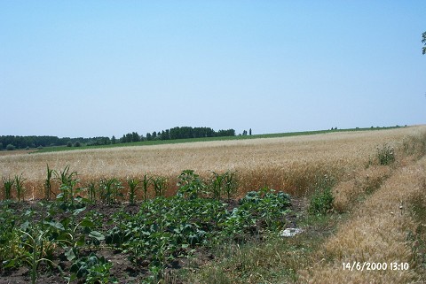
| Destruction Details: The western section of the settlement is used for wheat; the eastern for sunflower cultivation. A tractor road passes over it in the north-south direction [TAYEx 14.6.2000]. |