| ©The Archaeological Settlements of Turkey - TAY Project | ||||||
|
|
||||||
Baladiz / Baradiz |
||||||
|
|
||||||
| Ages | Maps | Photos | ||||
| Palaeolithic/Epipalaeolithic EBA |
 |
 |
||||
|
|
||||||
|
Type:
|
Habitation Site / Workshop | |||||
|
Altitude:
|
890 m | |||||
|
Diameter:
|
m- Direction: | |||||
|
|
||||||
|
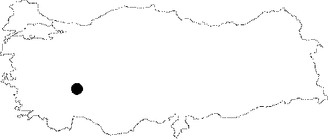
Region:
|
Mediterranean | |||||
|
Province:
|
Isparta | |||||
|
District:
|
Gönen | |||||
|
Village:
|
Gümüsgün | |||||
|
|
||||||
|
Destruction :
|
Highways, roads, bridges etc. | |||||
|
|
||||||
|
TAYEx:
|
Visited - 1/7/2001 | |||||
|
|
||||||
|
Registration State:
|
For detailed registration information please refer to Turkish pages. | |||||
 |
||||||
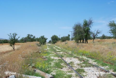
| Location: This site lies between Gümüsgün (Baradiz) and Igdecik villages; southeast of Gönen District; northwest Isparta Province. It is 2.3 km away from the Gümüsgün train station. It lies on either side of a small hill that has been carved by railroad tracks. |
| Geography and Environment: The site lies on a small hill where the Gönen and the Keçiborlu plains meet. Although the diameter of the hill is reported to be approximately 80-100 m across; its height above the plains is not given. According to H. R. Cohen and Oguz Erol who conducted geomorphological studies in the area; the soft sand on the surface of this hill indicates that this hill used to be located near the earlier shores of the lake and that this elevated terrain was formed when the Burdur Lake rose. Erol further suggests that the first human activity in the area dates to the end of the last Ice Age when the level of the Burdur lake fell from 950-945 m to 935-930 m. This must have been a suitable region for hunting in the Epipalaeolithic. |
| Destruction Details: The mound has been separated into two by the railroad [TAYEx 1.7.2001]. |