| ©The Archaeological Settlements of Turkey - TAY Project | ||||||
|
|
||||||
Yügücek |
||||||
|
|
||||||
| Ages | Maps | Photos | ||||
| Neolithic EBA |
 |
 |
||||
|
|
||||||
|
Type:
|
Mound | |||||
|
Altitude:
|
128 m | |||||
|
Diameter:
|
m- Direction: | |||||
|
|
||||||
|
Region:
|
Marmara | |||||
|
Province:
|
Bursa | |||||
|
District:
|
Iznik | |||||
|
Village:
|
Merkez | |||||
|
|
||||||
|
Destruction :
|
Agriculture - Contemporary Settlements - Attention | |||||
|
|
||||||
|
TAYEx:
|
Visited - 17/7/2000 | |||||
|
|
||||||
|
Registration State:
|
Registered For detailed registration information please refer to Turkish pages. | |||||
 |
||||||
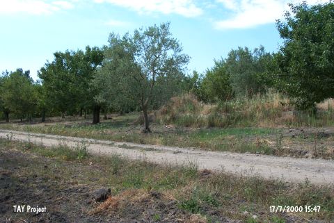
| Location: This site is northeast of the city of Bursa; 1 km south of the town of Iznik; west of the Iznik-Yenisehir highway. |
| Geography and Environment: The mound; which is 3 m high and has a 100 m diameter; is 1 km from the Iznik Lake in the fertile Iznik Plain. |
| Destruction Details: The mound has been completely leveled to make an apple garden. There are building foundations on the top of it. Contemporary settlements have been built on the eastern skirt [TAYEx 17.7.2000]. |