| ©The Archaeological Settlements of Turkey - TAY Project | ||||||
|
|
||||||
Yilanlik Mevkii |
||||||
|
|
||||||
| Ages | Maps | Photos | ||||
| Neolithic |
 |
 |
||||
|
|
||||||
|
Type:
|
Artifact Scatter | |||||
|
Altitude:
|
25 m | |||||
|
Diameter:
|
m- Direction: | |||||
|
|
||||||
|
Region:
|
Marmara | |||||
|
Province:
|
Balikesir | |||||
|
District:
|
Gönen | |||||
|
Village:
|
Sariköy | |||||
|
|
||||||
|
Destruction :
|
Agriculture - Highways, roads, bridges etc. - Attention | |||||
|
|
||||||
|
TAYEx:
|
Visited - 3/7/2000 | |||||
|
|
||||||
|
Registration State:
|
For detailed registration information please refer to Turkish pages. | |||||
 |
||||||
| Location: |
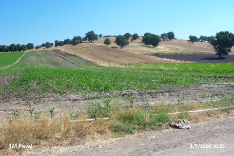
| Geography and Environment: |
| Destruction Details: The settlement is cut by a road. A water channel parallel to this road was built on the southern section and it has damaged the skirts. The whole area of the site is leveled by DSI (State Hydraulic Works) [TAYEx 3.7.2000]. |