| ©The Archaeological Settlements of Turkey - TAY Project | ||||||
|
|
||||||
Yeniköy |
||||||
|
|
||||||
| Ages | Maps | Photos | ||||
| Chalcolithic |
 |
 |
||||
|
|
||||||
|
Type:
|
Mound | |||||
|
Altitude:
|
130 m | |||||
|
Diameter:
|
m- Direction: | |||||
|
|
||||||
|
Region:
|
Mediterranean | |||||
|
Province:
|
Adana | |||||
|
District:
|
Yumurtalik | |||||
|
Village:
|
Yalak | |||||
|
|
||||||
|
Destruction :
|
Agriculture - Highways, roads, bridges etc. | |||||
|
|
||||||
|
TAYEx:
|
Visited - 29/7/2001 | |||||
|
|
||||||
|
Registration State:
|
For detailed registration information please refer to Turkish pages. | |||||
 |
||||||
| Location: |
| Geography and Environment: |
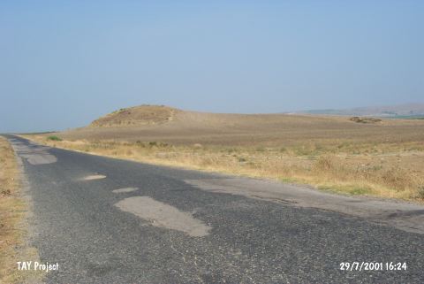
| Destruction Details: The mound has been damaged due to agricultural activities and Yumurtalik-Yeniköy road cutting its western skirt. North and west parts of the mound are planted and there is a well on western skirt. The eastern slope is damaged due to illicit diggings [TAYEx 29.7.2001]. |