| ©The Archaeological Settlements of Turkey - TAY Project | ||||||
|
|
||||||
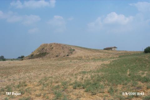
Yasil Höyük |
||||||
|
|
||||||
| Ages | Maps | Photos | ||||
| Chalcolithic EBA |
 |
 |
||||
|
|
||||||
|
Type:
|
Mound | |||||
|
Altitude:
|
100 m | |||||
|
Diameter:
|
m- Direction: | |||||
|
|
||||||
|
Region:
|
Mediterranean | |||||
|
Province:
|
Adana | |||||
|
District:
|
Ceyhan | |||||
|
Village:
|
Çiçekli | |||||
|
|
||||||
|
Destruction :
|
Agriculture - Contemporary Settlements | |||||
|
|
||||||
|
TAYEx:
|
Visited - 2/8/2001 | |||||
|
|
||||||
|
Registration State:
|
For detailed registration information please refer to Turkish pages. | |||||
 |
||||||
| Location: |
| Geography and Environment: |
| Destruction Details: The mound has been damaged due to agricultural activities. It has been leveled with a declination through southern skirt. The original height can be distinguished from the place where the survey point locates. There is a house on south-southeast skirt and the other skirts have been leveled also [TAYEx 2.8.2001]. |