| ©The Archaeological Settlements of Turkey - TAY Project | ||||||
|
|
||||||
Yalnizsaray |
||||||
|
|
||||||
| Ages | Maps | Photos | ||||
| EBA |
 |
 |
||||
|
|
||||||
|
Type:
|
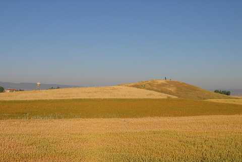
Mound | |||||
|
Altitude:
|
975 m | |||||
|
Diameter:
|
55 m- Direction: E-W | |||||
|
|
||||||
|
Region:
|
Aegean | |||||
|
Province:
|
Kütahya | |||||
|
District:
|
Altintas | |||||
|
Village:
|
Yanlizsaray | |||||
|
|
||||||
|
Destruction :
|
Illicit Digging - Agriculture - Attention | |||||
|
|
||||||
|
TAYEx:
|
Visited - 6/7/2004 | |||||
|
|
||||||
|
Registration State:
|
Registered For detailed registration information please refer to Turkish pages. | |||||
 |
||||||
| Location: |
| Geography and Environment: |
| Destruction Details: The mound is surrounded by wheat fields and its skirts have been cut to make way for fields. On the top of it is an illicit digging pit measuring 4.40x2.50 m in width and 1.10 m in depth [TAYEx 6.7.2004]. |