| ©The Archaeological Settlements of Turkey - TAY Project | ||||||
|
|
||||||
Tülintepe |
||||||
|
|
||||||
| Ages | Maps | Photos | ||||
| Chalcolithic EBA IA 14C |
 |
 |
||||
|
|
||||||
|
Type:
|
Mound | |||||
|
Altitude:
|
830 m | |||||
|
Diameter:
|
m- Direction: | |||||
|
|
||||||
|
Region:
|
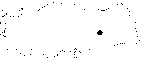
Eastern Anatolia | |||||
|
Province:
|
Elazig | |||||
|
District:
|
Merkez | |||||
|
Village:
|
||||||
|
|
||||||
|
Destruction :
|
Dams | |||||
|
|
||||||
|
TAYEx:
|
Not visited - 15/8/2003 | |||||
|
|
||||||
|
Registration State:
|
For detailed registration information please refer to Turkish pages. | |||||
 |
||||||
| Location: Before it was inundated by Keban Dam; the site used to lie approximately 21 km east of Elazig; between and close to the old Elazig-Bingöl railway and highway. |
| Geography and Environment: Tülintepe is one of the five mounds; inundated by Keban Dam. Moreover; soil from Tülintepe was used to construct a new railway; because Elazig-Bingöl railway and highway were going to be inundated. Therefore; upper parts of the mound were removed by a bulldozer; thus destroying the upper layers. Tülintepe was 200x250 m in area and 16.60 m high before the destruction. Geophysical analyses suggest that the deposit of the mound still continues down to 5/6 m below the surface [Esin-Arsebük 1974b:137; 139]. |
| Destruction Details: The mound is flooded by dam reservoir [TAYEx 15.8.2003]. |