| ©The Archaeological Settlements of Turkey - TAY Project | ||||||
|
|
||||||
Toptepe |
||||||
|
|
||||||
| Ages | Maps | Photos | ||||
| Chalcolithic EBA IA 14C |
 |
 |
||||
|
|
||||||
|
Type:
|
Mound | |||||
|
Altitude:
|
7 m | |||||
|
Diameter:
|
m- Direction: | |||||
|
|
||||||
|
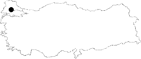
Region:
|
Marmara | |||||
|
Province:
|
Tekirdag | |||||
|
District:
|
Marmara Ereglisi | |||||
|
Village:
|
||||||
|
|
||||||
|
Destruction :
|
Contemporary Settlements - Attention | |||||
|
|
||||||
|
TAYEx:
|
Visited - 27/5/2000 | |||||
|
|
||||||
|
Registration State:
|
For detailed registration information please refer to Turkish pages. | |||||
 |
||||||
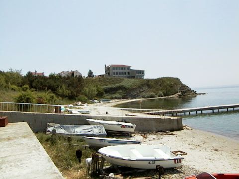
| Location: The site lies east of Tekirdag; approximately 4 km west of Marmara Ereglisi; approximately 300 m south of the Tekirdag-Istanbul highway. Today; it is in the limits of a holiday site called "Kaptan 2". There is not much to see because of extreme damage. The mound is reached via the road from Istanbul to Tekirdag; but permission is required to enter the holiday site. |
| Geography and Environment: A very large part of the mound was destroyed during the construction of a casino of Kaptan 2 in 1989. The deposit of the mound was 10-12 m thick before the destruction. The terrace; extending towards north; was destroyed by buildings. The first settlers inhabited a 70 m wide rocky cape. The small indentations at two sides of the cape most probably functioned as a suitable small bay; providing shelter for the fisherman boats. |
| Destruction Details: The casino of Kaptan 2 was built over the mound. The deposit of the mound around the casino was leveled; the left over soil was heaped in front of the casino. Pottery sherds can be seen in this heap. The fill remaining on the bedrock is 30-40 m in height [TAYEx 27.5.2000]. |