| ©The Archaeological Settlements of Turkey - TAY Project | ||||||
|
|
||||||
Tilafsin / Tell Afsin |
||||||
|
|
||||||
| Ages | Maps | Photos | ||||
| Chalcolithic |
 |
 |
||||
|
|
||||||
|
Type:
|
Mound | |||||
|
Altitude:
|
1210 m | |||||
|
Diameter:
|
m- Direction: | |||||
|
|
||||||
|
Region:
|
Eastern Anatolia | |||||
|
Province:
|
Kahramanmaras | |||||
|
District:
|
Afsin | |||||
|
Village:
|
Hüyüklü | |||||
|
|
||||||
|
Destruction :
|
Illicit Digging - Contemporary Settlements - Attention | |||||
|
|
||||||
|
TAYEx:
|
Visited - 7/8/2001 | |||||
|
|
||||||
|
Registration State:
|
Registered For detailed registration information please refer to Turkish pages. | |||||
 |
||||||
| Location: |
| Geography and Environment: |
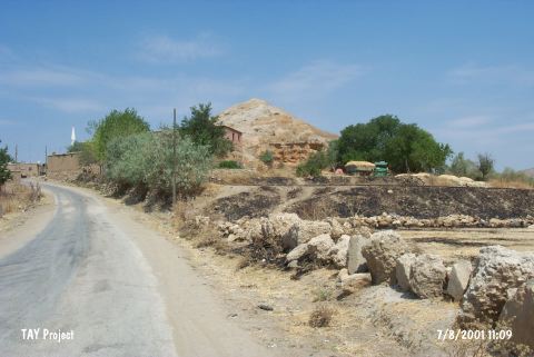
| Destruction Details: Soil has been removed from the south and southwest skirts of the mound for 30 years. There are houses on south skirt and a pit of illicit digging with the dimensions of 5 m depth and 3 m length on southeast skirt [TAYEx 7.8.2001]. |