| ©The Archaeological Settlements of Turkey - TAY Project | ||||||
|
|
||||||
Tarmil Höyük |
||||||
|
|
||||||
| Ages | Maps | Photos | ||||
| Neolithic Chalcolithic EBA |
 |
 |
||||
|
|
||||||
|
Type:
|
Mound | |||||
|
Altitude:
|
120 m | |||||
|
Diameter:
|
m- Direction: | |||||
|
|
||||||
|
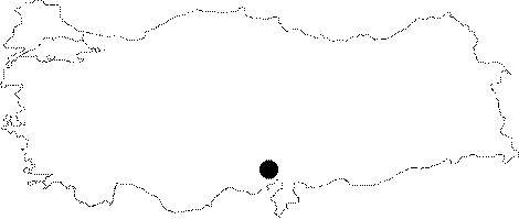
Region:
|
Mediterranean | |||||
|
Province:
|
Adana | |||||
|
District:
|
Kozan | |||||
|
Village:
|
Ufacikören | |||||
|
|
||||||
|
Destruction :
|
Illicit Digging - Agriculture - Highways, roads, bridges etc. - Attention | |||||
|
|
||||||
|
TAYEx:
|
Visited - 30/7/2001 | |||||
|
|
||||||
|
Registration State:
|
Registered For detailed registration information please refer to Turkish pages. | |||||
 |
||||||
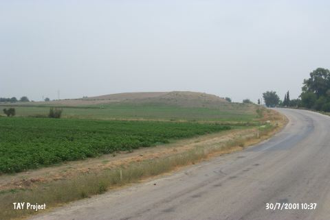
| Location: The mound lies 3.8 km northwest of Ufacikören Village; approximately 12.5 km southwest of Kozan District; 84 km northeast of Adana Province. |
| Geography and Environment: The mound is fairly large in size. It has a 90x70 m base and is between 25 and 30 m high. It lies in a small plain fed by Kurucuoglu Stream. In some publications; the site has been called Termel or Tirmir. Southeast of the mound cemetery of the village takes place. |
| Destruction Details: The top hill has been severely damaged due to plowing. All eastern part has been cut and the profile starting from 1 m reaches 12 m at this section. There are also traces of illicit diggings observed here. The northern skirt has been cut by village road an eastern one by Adana-Kozan motorway [TAYEx 30.7.2001]. |