| ©The Archaeological Settlements of Turkey - TAY Project | ||||||
|
|
||||||
Sehremuz ve Çevresi |
||||||
|
|
||||||
| Ages | Maps | Photos | ||||
| Palaeolithic/Epipalaeolithic |
 |
 |
||||
|
|
||||||
|
Type:
|
Habitation Site / Workshop | |||||
|
Altitude:
|
m | |||||
|
Diameter:
|
m- Direction: | |||||
|
|
||||||
|
Region:
|
Southeastern Anatolia | |||||
|
Province:
|
Adiyaman | |||||
|
District:
|
Samsat | |||||
|
Village:
|
Hacihalilan | |||||
|
|
||||||
|
Destruction :
|
Dams | |||||
|
|
||||||
|
TAYEx:
|
Not visited - 26/9/2001 | |||||
|
|
||||||
|
Registration State:
|
For detailed registration information please refer to Turkish pages. | |||||
 |
||||||
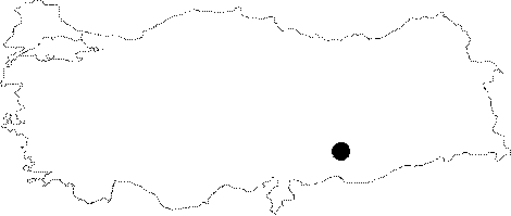
| Location: This open-air site was located southeast of the city of Adiyaman and northwest of the Euphrates River Valley before it was submerged beneath the Atatürk Dam Lake. The site was bounded by the district of Agaköy and the Çevrin highway to the north; by the ridge immediately northwest of the Dökülün Ridge to the west; by the Gavurbaglari vineyards to the east and by the Gazikumçakiranalar to the southeast. It was located in and around Sehremuz; a region above the Kelusk Stream before it empties into the Hamiskan Stream. It also lay north of the town of Samsat; a town which has now been completely flooded by the dam lake [Yalçinkaya 1984:map of plan 1]. The survey code of this site is T 51 / 22. |
| Geography and Environment: Because the Sehremuz Ridge is especially rich in flintstone outcrops; the area has been a preferred location for prehistoric occupation. Along with small stream such as the Kelusk; the Euphrates has been flowing through the region supplying people and animals with water. Hunting was probably a long practiced means of subsistence because the fertile region by the Euphrates must have attracted wild herbivores. The streamlets in the region have given the area an undulating appearance although there is a flat terrace above the Sehremuz Ridge. |
| Destruction Details: Sehremuz ve Çevresi is flooded by Atatürk Dam reservoir today [TAYEx 26.9.2001]. |