| ©The Archaeological Settlements of Turkey - TAY Project | ||||||
|
|
||||||
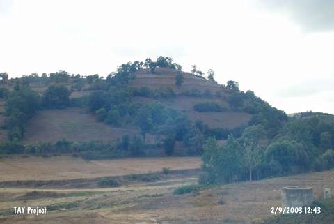
Ay Tepe |
||||||
|
|
||||||
| Ages | Maps | Photos | ||||
| EBA IA |
 |
 |
||||
|
|
||||||
|
Type:
|
Mound | |||||
|
Altitude:
|
740 m | |||||
|
Diameter:
|
m- Direction: | |||||
|
|
||||||
|
Region:
|
Black Sea | |||||
|
Province:
|
Samsun | |||||
|
District:
|
Kavak | |||||
|
Village:
|
Kuzalan | |||||
|
|
||||||
|
Destruction :
|
Illicit Digging | |||||
|
|
||||||
|
TAYEx:
|
Visited - 2/9/2003 | |||||
|
|
||||||
|
Registration State:
|
For detailed registration information please refer to Turkish pages. | |||||
 |
||||||
| Location: |
| Geography and Environment: |
| Destruction Details: Traces of illicit diggings were observed on the southeastern part of the mound. Its northern slope was damaged due to terracing [TAYEx 2.9.2003]. |