| ©The Archaeological Settlements of Turkey - TAY Project | ||||||
|
|
||||||
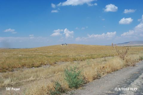
Sigirci |
||||||
|
|
||||||
| Ages | Maps | Photos | ||||
| EBA |
 |
 |
||||
|
|
||||||
|
Type:
|
Mound | |||||
|
Altitude:
|
1070 m | |||||
|
Diameter:
|
214 m- Direction: NW-SE | |||||
|
|
||||||
|
Region:
|
Central Anatolia | |||||
|
Province:
|
Karaman | |||||
|
District:
|
Merkez | |||||
|
Village:
|
||||||
|
|
||||||
|
Destruction :
|
Contemporary Settlements | |||||
|
|
||||||
|
TAYEx:
|
Visited - 17/8/2002 | |||||
|
|
||||||
|
Registration State:
|
For detailed registration information please refer to Turkish pages. | |||||
 |
||||||
| Location: |
| Geography and Environment: |
| Destruction Details: There is and old grave belonging to a holly man and some other graves on top hill. Remains of stone houses observed on southwest slope [TAYEx 17.8.2002]. |