| ©The Archaeological Settlements of Turkey - TAY Project | ||||||
|
|
||||||
Selimpasa |
||||||
|
|
||||||
| Ages | Maps | Photos | ||||
| EBA IA |
 |
 |
||||
|
|
||||||
|
Type:
|
Mound | |||||
|
Altitude:
|
10 m | |||||
|
Diameter:
|
m- Direction: | |||||
|
|
||||||
|
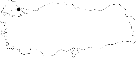
Region:
|
Marmara | |||||
|
Province:
|
Istanbul | |||||
|
District:
|
Silivri | |||||
|
Village:
|
Selimpasa | |||||
|
|
||||||
|
Destruction :
|
Agriculture - Contemporary Settlements - Attention | |||||
|
|
||||||
|
TAYEx:
|
Visited - 27/5/2000 | |||||
|
|
||||||
|
Registration State:
|
Registered For detailed registration information please refer to Turkish pages. | |||||
 |
||||||
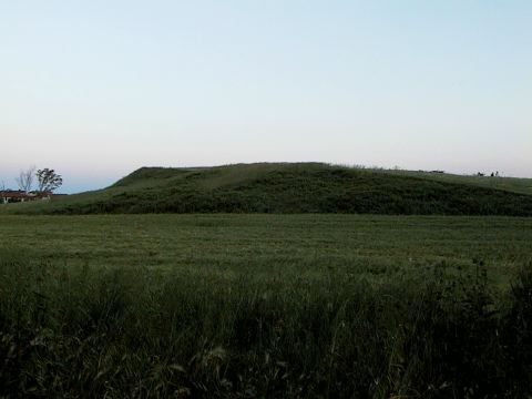
| Location: It lies some 3 km west of the Selimpasa Village of the Silivri District; west of the Istanbul Province. It is one of the biggest mounds on the shore of Marmara Sea in the Thrace Region. Istanbul-Tekirdag motorway runs to the south of the mound. Between the motorway and the mound; is a secondary road to Selimpasa. |
| Geography and Environment: There is a small bay where the Kavakli and Kocadere Streams spill to; located west of Selimpasa Village. The mound stands on a natural elevation at the mouth of the stream; on the eastern bank of Kavakli Stream. The western foots of the hill are steep and the eastern and southern slopes are slightly inclined. The mound; threatened by the modern settlement to its west and west; has been taken under protection as a result of the announcement by the Istanbul Archaeological Museum as a registered site. |
| Destruction Details: The mound is being used for planting wheat. On the western skirt is a low wall made from one row of briquette as a field border. The site is threatened by the modern settlement extending towards the skirts of the mound [TAYEx 27.5.2000]. During the survey performed by S. Aydingün et al. in 2007 it was found that soil was removed from the mound , and it's size is smaller. A heliport was built on it and it is currently being used for helicopters to land [Aydıngün 2009:414]. |