| ©The Archaeological Settlements of Turkey - TAY Project | ||||||
|
|
||||||
Oruçoglu |
||||||
|
|
||||||
| Ages | Maps | Photos | ||||
| EBA |
 |
 |
||||
|
|
||||||
|
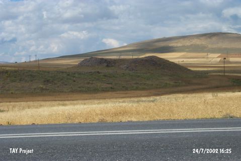
Type:
|
Mound | |||||
|
Altitude:
|
1500 m | |||||
|
Diameter:
|
90 m- Direction: NW-SE | |||||
|
|
||||||
|
Region:
|
Central Anatolia | |||||
|
Province:
|
Kayseri | |||||
|
District:
|
Bünyan | |||||
|
Village:
|
Oruçoglu | |||||
|
|
||||||
|
Destruction :
|
Illicit Digging | |||||
|
|
||||||
|
TAYEx:
|
Visited - 24/7/2002 | |||||
|
|
||||||
|
Registration State:
|
For detailed registration information please refer to Turkish pages. | |||||
 |
||||||
| Location: |
| Geography and Environment: |
| Destruction Details: The site has been completely damaged due to illicit diggings. There are group of stones on all over it [TAYEx 24.7.2002]. |