| ©The Archaeological Settlements of Turkey - TAY Project | ||||||
|
|
||||||
Okçu |
||||||
|
|
||||||
| Ages | Maps | Photos | ||||
| Palaeolithic/Epipalaeolithic |
 |
 |
||||
|
|
||||||
|
Type:
|
Habitation Site / Workshop | |||||
|
Altitude:
|
760 m | |||||
|
Diameter:
|
m- Direction: | |||||
|
|
||||||
|
Region:
|
Southeastern Anatolia | |||||
|
Province:
|
Batman | |||||
|
District:
|
Akça | |||||
|
Village:
|
Okçu | |||||
|
|
||||||
|
|
||||||
|
|
||||||
|
TAYEx:
|
Not visited - 16/9/2001 | |||||
|
|
||||||
|
Registration State:
|
For detailed registration information please refer to Turkish pages. | |||||
 |
||||||
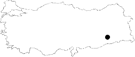
| Location: The site lies at the foothills of the Raman Mountains near the village of Okçu located east of the city of Batman. |
| Geography and Environment: Mount Raman is located in the eastern portion of the Raman Valley and Batman River watershed. The Tigris flows south of this mountain through a terraced canyon. Post-Pleistocene settlements are rarely seen in this region. A two week surface survey at this habitation/atelier site conducted in 1989 yielded widely scattered flintstone tools and debitage products. Okçu is the most important of these settlements. |
| Destruction Details: |