| ©The Archaeological Settlements of Turkey - TAY Project | ||||||
|
|
||||||
Malaliki Magarasi |
||||||
|
|
||||||
| Ages | Maps | Photos | ||||
| Palaeolithic/Epipalaeolithic |
 |
 |
||||
|
|
||||||
|
Type:
|
Rock Shelter | |||||
|
Altitude:
|
m | |||||
|
Diameter:
|
m- Direction: | |||||
|
|
||||||
|
Region:
|
Southeastern Anatolia | |||||
|
Province:
|
Diyarbakir | |||||
|
District:
|
Silvan | |||||
|
Village:
|
Kazandagi | |||||
|
|
||||||
|
|
||||||
|
|
||||||
|
TAYEx:
|
Not visited - 23/9/2001 | |||||
|
|
||||||
|
Registration State:
|
For detailed registration information please refer to Turkish pages. | |||||
 |
||||||
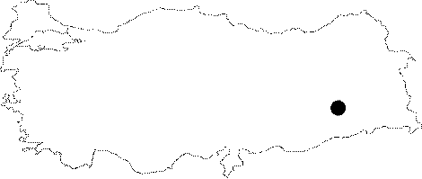
| Location: This rock-shelter site is in the province of Diyarbakir; northwest of the town of Silvan; 9.5 km; as the crow flies; northwest of the Batman dam fill; east-southeast of the village of Hokan; on the east flank of one of the branches feeding the Sarim Stream; approximately 700 meters from this larger stream. |
| Geography and Environment: Although the exact dimensions of this "rock-shelter" in the mountainous area by the village of Malaliki are not reported; because Rosenberg calls it a "cave"; it can be assumed that it is large in size. |
| Destruction Details: |