| ©The Archaeological Settlements of Turkey - TAY Project | ||||||
|
|
||||||
Küçük Höyük ve Mezarligi |
||||||
|
|
||||||
| Ages | Maps | Photos | ||||
| EBA |
 |
 |
||||
|
|
||||||
|
Type:
|
Mound and Cemetery | |||||
|
Altitude:
|
750 m | |||||
|
Diameter:
|
m- Direction: | |||||
|
|
||||||
|
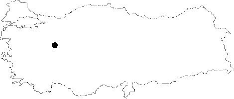
Region:
|
Marmara | |||||
|
Province:
|
Bilecik | |||||
|
District:
|
Bozüyük | |||||
|
Village:
|
Merkez | |||||
|
|
||||||
|
Destruction :
|
Contemporary Settlements - Attention | |||||
|
|
||||||
|
TAYEx:
|
Visited - 19/6/2002 | |||||
|
|
||||||
|
Registration State:
|
For detailed registration information please refer to Turkish pages. | |||||
 |
||||||
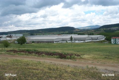
| Location: It is located in territory of factory of Toprak Ceramic; about 50 km north of Bursa-Eskisehir motorway; 5 km east of the Bozüyük District; some 50 km northwest of the Eskisehir Province. Cemetery suggested to be belonging to the inhabitants of this site lies on a ridge; 400 m southwest of the hill. Between the mound and the cemetery lies the ceramics factory of the Toprak Group. Cemetery is located on the northeastern border of the garden of the factory. Both the mound and the cemetery are easily accessible [Gürkan-Seeher 1991:pl.1]. |
| Geography and Environment: The mound and the cemetery are located on the foot of a mountain range. The mound is near a fertile lowland where a stream passes through. It measures 4 m in height and 60 m in diameter; and has a round shape [Gürkan-Seeher 1991:pl.1] while the cemetery located on the southwestern slope of a ridge called Çakirmandira with an altitude of 807 m covers an area of 75x60 m [Gürkan-Seeher 1991:pl.2]. A Byzantine church rising on the northern part of the ceramics factory expose that the site had good water resources. Both the mound and the cemetery were partly damaged during the construction of the factory. Pits opened for the natural gas piping resulted in the damaging of a small part of the cemetery. |
| Destruction Details: The site is almost vanished. It has been remained under the product warehouse of factory of Toprak Ceramic [TAYEx 19.6.2002]. |