| ©The Archaeological Settlements of Turkey - TAY Project | ||||||
|
|
||||||
Küçük Çekmece Yöresi |
||||||
|
|
||||||
| Ages | Maps | Photos | ||||
| Palaeolithic/Epipalaeolithic |
 |
 |
||||
|
|
||||||
|
Type:
|
Habitation Site / Workshop | |||||
|
Altitude:
|
80 m | |||||
|
Diameter:
|
m- Direction: | |||||
|
|
||||||
|
Region:
|
Marmara | |||||
|
Province:
|
Istanbul | |||||
|
District:
|
Avcilar | |||||
|
Village:
|
||||||
|
|
||||||
|
|
||||||
|
|
||||||
|
TAYEx:
|
- | |||||
|
|
||||||
|
Registration State:
|
For detailed registration information please refer to Turkish pages. | |||||
 |
||||||
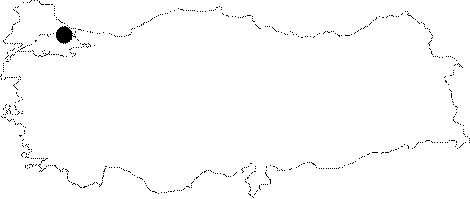
| Location: This site; which is west of Istanbul; and the Küçük Çekmece Lake includes several different artifact scatters. One of these is the HARAMIDERE artifact scatter on the eastern bank of the Haramidere Valley. Another; closer to the sea; is the AMBARLI artifact scatter; named after the town of Ambarli to its north. The AVCILAR artifact scatter northeast of the town of Avcilar; is also very close to the Küçük Çekmece Lake. The final artifact scatter which is northwest of the lake and therefore south of the TEM highway is called KARTALTEPE. |
| Geography and Environment: There is no detailed information provided on the geographic or topographic location of this site. The surveyors who revisited the site in 1983 discovered that it was completely destroyed by the construction of the TEM highway [Özdogan 1985:223]. |
| Destruction Details: |