| ©The Archaeological Settlements of Turkey - TAY Project | ||||||
|
|
||||||
Kuruçay |
||||||
|
|
||||||
| Ages | Maps | Photos | ||||
| Neolithic Chalcolithic EBA 14C |
 |
 |
||||
|
|
||||||
|
Type:
|
Mound | |||||
|
Altitude:
|
935 m | |||||
|
Diameter:
|
m- Direction: | |||||
|
|
||||||
|
Region:
|
Mediterranean | |||||
|
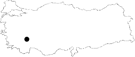
Province:
|
Burdur | |||||
|
District:
|
Merkez | |||||
|
Village:
|
Kuruçay | |||||
|
|
||||||
|
|
||||||
|
|
||||||
|
TAYEx:
|
Visited - 9/6/2001 | |||||
|
|
||||||
|
Registration State:
|
Registered For detailed registration information please refer to Turkish pages. | |||||
 |
||||||
| Location: This site lies west of the town of Burdur; by the fifteenth kilometer of the highway going west from Burdur towards Yesilova and Tefenni. It is 1.5 km southwest of Kuruçay Stream; which is very close to the highway. |
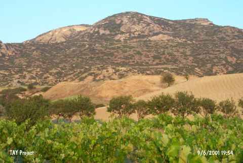
| Geography and Environment: The mound of Kuruçay lies on an undulating plain; on the stepped hills facing Lake Burdur. It lies in an area with deep river beds on its south; west and northern sides. The mound is 8 m high and has a 90x60 m base. It is 960 m above sea level and 110 m above Lake Burdur [Özsait 1979:102; Duru 1994a:1;83]. |
| Destruction Details: |