| ©The Archaeological Settlements of Turkey - TAY Project | ||||||
|
|
||||||
Kösk Höyük |
||||||
|
|
||||||
| Ages | Maps | Photos | ||||
| Neolithic Chalcolithic IA 14C |
 |
 |
||||
|
|
||||||
|
Type:
|
Mound | |||||
|
Altitude:
|
1400 m | |||||
|
Diameter:
|
m- Direction: | |||||
|
|
||||||
|
Region:
|
Central Anatolia | |||||
|
Province:
|
Nigde | |||||
|
District:
|
Bor | |||||
|
Village:
|
Bahçeli | |||||
|
|
||||||
|
|
||||||
|
|
||||||
|
TAYEx:
|
Not visited - 9/8/2002 | |||||
|
|
||||||
|
Registration State:
|
Registered For detailed registration information please refer to Turkish pages. | |||||
 |
||||||
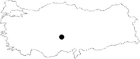
| Location: The site lies in the province of Nigde; close to Bahçeli Village; 17 km to the centrum; on the Kayseri-Nigde-Adana highway [Silistreli 1984a:83]. |
| Geography and Environment: A Roman Period artificial pool located at the southern skirts of the mound is supplied by a natural spring closely which proves that; at least 2000 years ago; the region was watery and fertile just like in the present. The mound is 80 m in diameter and 15 m in height [Harmankaya et al. 1997:Kösk Höyük]. |
| Destruction Details: |