| ©The Archaeological Settlements of Turkey - TAY Project | ||||||
|
|
||||||
Kocahöyük |
||||||
|
|
||||||
| Ages | Maps | Photos | ||||
| EBA |
 |
 |
||||
|
|
||||||
|
Type:
|
Flat Settlement | |||||
|
Altitude:
|
115 m | |||||
|
Diameter:
|
m- Direction: | |||||
|
|
||||||
|
Region:
|
Marmara | |||||
|
Province:
|
Edirne | |||||
|
District:
|
Süloglu | |||||
|
Village:
|
Geçkinli | |||||
|
|
||||||
|
Destruction :
|
Illicit Digging - Agriculture - Highways, roads, bridges etc. | |||||
|
|
||||||
|
TAYEx:
|
Visited - 14/6/2000 | |||||
|
|
||||||
|
Registration State:
|
For detailed registration information please refer to Turkish pages. | |||||
 |
||||||
| Location: |
| Geography and Environment: |
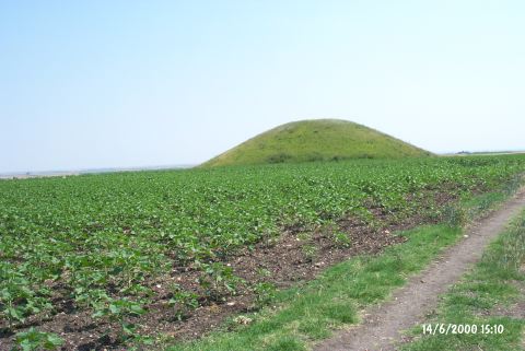
| Destruction Details: Illicit pits were observed on the tumulus located on the southern section of the settlement. A tractor road in the north-south direction passes over the western slope [TAYEx 14.6.2000]. |