| ©The Archaeological Settlements of Turkey - TAY Project | ||||||
|
|
||||||
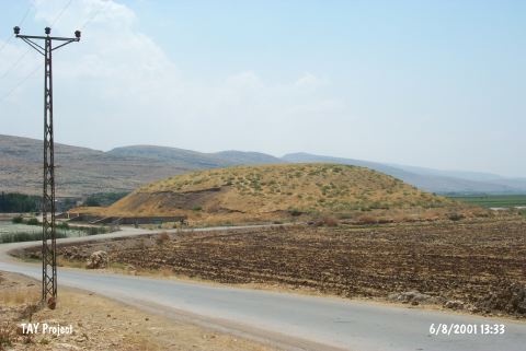
KM 88 Çoçelli |
||||||
|
|
||||||
| Ages | Maps | Photos | ||||
| Chalcolithic |
 |
 |
||||
|
|
||||||
|
Type:
|
Mound | |||||
|
Altitude:
|
560 m | |||||
|
Diameter:
|
m- Direction: | |||||
|
|
||||||
|
Region:
|
Mediterranean | |||||
|
Province:
|
Kahramanmaras | |||||
|
District:
|
Pazarcik | |||||
|
Village:
|
Çöçelli | |||||
|
|
||||||
|
Destruction :
|
Contemporary Settlements | |||||
|
|
||||||
|
TAYEx:
|
Visited - 6/8/2001 | |||||
|
|
||||||
|
Registration State:
|
For detailed registration information please refer to Turkish pages. | |||||
 |
||||||
| Location: |
| Geography and Environment: |
| Destruction Details: The eastern skirt of the mound is cut by the pond in the same direction which is being used for watering the fields around. There are four houses and a soil removed section on southern skirt [TAYEx 6.8.2001]. |