| ©The Archaeological Settlements of Turkey - TAY Project | ||||||
|
|
||||||
Anep Sirti |
||||||
|
|
||||||
| Ages | Maps | Photos | ||||
| Palaeolithic/Epipalaeolithic |
 |
 |
||||
|
|
||||||
|
Type:
|
Habitation Site / Workshop | |||||
|
Altitude:
|
m | |||||
|
Diameter:
|
m- Direction: | |||||
|
|
||||||
|
Region:
|
Southeastern Anatolia | |||||
|
Province:
|
Adiyaman | |||||
|
District:
|
Kahta | |||||
|
Village:
|
Dardagan | |||||
|
|
||||||
|
Destruction :
|
Dams | |||||
|
|
||||||
|
TAYEx:
|
Not visited - 29/8/2001 | |||||
|
|
||||||
|
Registration State:
|
For detailed registration information please refer to Turkish pages. | |||||
 |
||||||
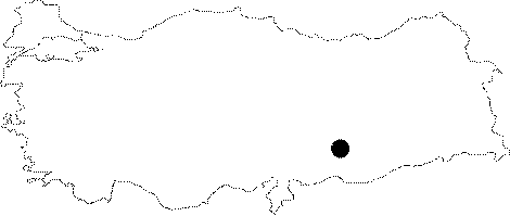
| Location: This open-air habitation site has recently been flooded by the Atatürk Dam Lake. It was east of the city of Adiyaman and close to the district of Kahta; situated on the flanks of the Anep Ridge southwest of the village of Dardagan; facing the Euphrates. Its survey code is T 52 / 16. |
| Geography and Environment: The high plateau that the villages of Dardagan; Keferkurus and the Anep Ridge lie on is cut by seasonal streams which have formed steep incising gorges. |
| Destruction Details: The site is flooded by dam reservoir today [TAYEx 29.8.2001]. |