| ©The Archaeological Settlements of Turkey - TAY Project | ||||||
|
|
||||||
Kizilözün |
||||||
|
|
||||||
| Ages | Maps | Photos | ||||
| EBA IA |
 |
 |
||||
|
|
||||||
|
Type:
|
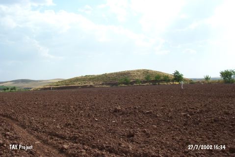
Mound | |||||
|
Altitude:
|
955 m | |||||
|
Diameter:
|
105 m- Direction: N-S | |||||
|
|
||||||
|
Region:
|
Central Anatolia | |||||
|
Province:
|
Nevsehir | |||||
|
District:
|
Avanos | |||||
|
Village:
|
||||||
|
|
||||||
|
Destruction :
|
Agriculture | |||||
|
|
||||||
|
TAYEx:
|
Visited - 27/7/2002 | |||||
|
|
||||||
|
Registration State:
|
For detailed registration information please refer to Turkish pages. | |||||
 |
||||||
| Location: |
| Geography and Environment: |
| Destruction Details: The mound has been damaged due to agricultural activities. All of its skirts have been cut in order to extend fields [TAYEx 27.7.2002]. |