| ©The Archaeological Settlements of Turkey - TAY Project | ||||||
|
|
||||||
Kizilin |
||||||
|
|
||||||
| Ages | Maps | Photos | ||||
| Palaeolithic/Epipalaeolithic |
 |
 |
||||
|
|
||||||
|
Type:
|
Cave | |||||
|
Altitude:
|
290 m | |||||
|
Diameter:
|
m- Direction: | |||||
|
|
||||||
|
Region:
|
Mediterranean | |||||
|
Province:
|
Antalya | |||||
|
District:
|
Merkez | |||||
|
Village:
|
Yagca | |||||
|
|
||||||
|
Destruction :
|
Natural causes | |||||
|
|
||||||
|
TAYEx:
|
Visited - 20/6/2001 | |||||
|
|
||||||
|
Registration State:
|
Registered For detailed registration information please refer to Turkish pages. | |||||
 |
||||||
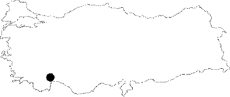
| Location: This cave-site is northwest of the city of Antalya; on Mount Katran; southwest of the Karain Cave; in the Çakmakli district of the village of Yagca. |
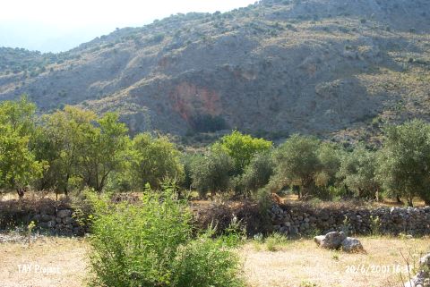
| Geography and Environment: The Kizilin Cave; like the Karain; Çarkini and Öküzini caves; is located on the northern fringes of Mount Katran facing the travertine formation. This mountain is composed of a grayish Crustaceous limestone which is prone to crack. This explains the origin of the many caves. The dike fissure has oriented the mouth of the Kizilin Cave east-southeast. This particular cave is 410 m above sea level and about 100 meters above the level of the plain it overlooks. The dimensions of the cave are 20 m east-west and 14 m north-south. The entrance to the cave; today; is only 1 m wide. It is presumed that the entry was wider in the Pleistocene. The floor of the cave runs at a steep slope although there is a flat terrace by the front entrance. Kökten; who opened a test trench in the outer terrace; reports that the cultural deposit is thick. Immediately below the cave; between Mount Katran and a hill known as Karagür Tepe is the northward flowing seasonal Kizilin Stream. Its stream bed yielded a wide variety of flint stone nodules suitable for tool making and rhyolite blocks; making this an appropriate raw material source for the inhabitants of this cave. The cultural deposit here is continually eroding. |
| Destruction Details: The mouth of the cave has been filled in with the soil moved by water [TAYEx 20.6.2001]. |