| ©The Archaeological Settlements of Turkey - TAY Project | ||||||
|
|
||||||
Kislak Civari |
||||||
|
|
||||||
| Ages | Maps | Photos | ||||
| Palaeolithic/Epipalaeolithic |
 |
 |
||||
|
|
||||||
|
Type:
|
Habitation Site / Workshop | |||||
|
Altitude:
|
510 m | |||||
|
Diameter:
|
m- Direction: | |||||
|
|
||||||
|
Region:
|
Mediterranean | |||||
|
Province:
|
Hatay | |||||
|
District:
|
Senköy | |||||
|
Village:
|
Kislak | |||||
|
|
||||||
|
|
||||||
|
|
||||||
|
TAYEx:
|
Visited - 23/7/2001 | |||||
|
|
||||||
|
Registration State:
|
For detailed registration information please refer to Turkish pages. | |||||
 |
||||||
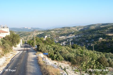
| Location: This open-air site is located 27 km south of the city of Antakya; south of the village of Kislak; which is about 9 km south of the town of Senköy. |
| Geography and Environment: The region; especially when compared with the Amik Ovasi Plain to its north; is mountainous. The streamlets running down into the plain from the surrounding mountains have eroded much of the topsoil as they carved themselves beds. |
| Destruction Details: |