| ©The Archaeological Settlements of Turkey - TAY Project | ||||||
|
|
||||||
Kinik |
||||||
|
|
||||||
| Ages | Maps | Photos | ||||
| Chalcolithic EBA |
 |
 |
||||
|
|
||||||
|
Type:
|
Mound | |||||
|
Altitude:
|
785 m | |||||
|
Diameter:
|
m- Direction: | |||||
|
|
||||||
|
Region:
|
Marmara | |||||
|
Province:
|
Bilecik | |||||
|
District:
|
Pazaryeri | |||||
|
Village:
|
Kinik | |||||
|
|
||||||
|
Destruction :
|
Agriculture | |||||
|
|
||||||
|
TAYEx:
|
Visited - 11/7/2000 | |||||
|
|
||||||
|
Registration State:
|
For detailed registration information please refer to Turkish pages. | |||||
 |
||||||
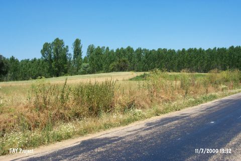
| Location: The mound is located southwest of the centrum of Bilecik; directly 5 km northwest of Pazaryeri District. It is at the junction of Kinik Village road and the highway; on the right and 300 m from the village. |
| Geography and Environment: It is a broad and shallow mound; 4 m in height and 150 m in diameter. Sorgun Stream flows from the southeast of it. Its surroundings are being cultivated in the present. |
| Destruction Details: The surface of the mound is being cultivated [TAYEx 11.7.2000]. |