| ©The Archaeological Settlements of Turkey - TAY Project | ||||||
|
|
||||||
Termera |
||||||
|
|
||||||
| Ages | Maps | Photos | ||||
| Greek-Roman |
 |
 |
||||
|
|
||||||
|
Type:
|
City | |||||
|
Altitude:
|
m | |||||
|
Diameter:
|
m- Direction: | |||||
|
|
||||||
|
Region:
|
Aegean | |||||
|
Province:
|
Mugla | |||||
|
District:
|
Bodrum | |||||
|
Village:
|
Aspat (Asarlik) | |||||
|
|
||||||
|
|
||||||
|
|
||||||
|
TAYEx:
|
- | |||||
|
|
||||||
|
Registration State:
|
Registered For detailed registration information please refer to Turkish pages. | |||||
 |
||||||
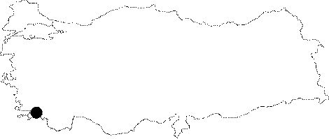
| Location: It is suggested that it was located on the hills above the Aspat Village; 15 km to the southwest of the Bodrum District of the Mugla Province. |
| Geography and Environment: |
| Destruction Details: |