| ©The Archaeological Settlements of Turkey - TAY Project | ||||||
|
|
||||||
Gerga |
||||||
|
|
||||||
| Ages | Maps | Photos | ||||
| Greek-Roman |
 |
 |
||||
|
|
||||||
|
Type:
|
Sanctuary | |||||
|
Altitude:
|
m | |||||
|
Diameter:
|
m- Direction: | |||||
|
|
||||||
|
Region:
|
Aegean | |||||
|
Province:
|
Aydin | |||||
|
District:
|
Çine | |||||
|
Village:
|
Ovacik | |||||
|
|
||||||
|
|
||||||
|
|
||||||
|
TAYEx:
|
- | |||||
|
|
||||||
|
Registration State:
|
Registered For detailed registration information please refer to Turkish pages. | |||||
 |
||||||
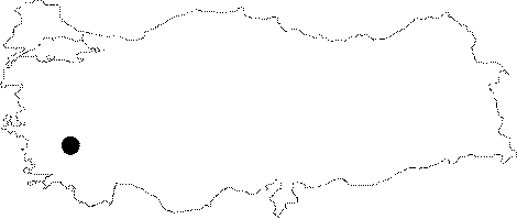
| Location: It is located near Ovacik; 12 km southeast of the Çine District of the Aydin Province [Bean 1976:349]. It is situated on the eastern bank of the Cine Brook (Marsyas during the ancient period); a branch of the Meander River [Held 1996:59]. |
| Geography and Environment: The sanctuary is situated on a mountaineous area. At present; it is surrounded by a few pine and olive trees. The land consists of dark grey gneiss rocks. The buildings in the sanctuary were made of these local stones [Held 1996:59]. |
| Destruction Details: |