| ©The Archaeological Settlements of Turkey - TAY Project | ||||||
|
|
||||||
Bagarcik Kalesi |
||||||
|
|
||||||
| Ages | Maps | Photos | ||||
| Greek-Roman |
 |
 |
||||
|
|
||||||
|
Type:
|
City | |||||
|
Altitude:
|
m | |||||
|
Diameter:
|
m- Direction: | |||||
|
|
||||||
|
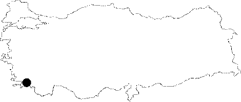
Region:
|
Aegean | |||||
|
Province:
|
Mugla | |||||
|
District:
|
Milas | |||||
|
Village:
|
Kapikiri | |||||
|
|
||||||
|
|
||||||
|
|
||||||
|
TAYEx:
|
- | |||||
|
|
||||||
|
Registration State:
|
For detailed registration information please refer to Turkish pages. | |||||
 |
||||||
| Location: It lies to the northeast of the Heracleia under Latmos; to the northwest of the Milas Disctrict of the Mugla Province. It is located on a 800 m high saddle of a mountain; 100 m above the road running from Çatal Geçit to the east. |
| Geography and Environment: |
| Destruction Details: |