| ©The Archaeological Settlements of Turkey - TAY Project | ||||||
|
|
||||||
Alagün |
||||||
|
|
||||||
| Ages | Maps | Photos | ||||
| Greek-Roman |
 |
 |
||||
|
|
||||||
|
Type:
|
City | |||||
|
Altitude:
|
m | |||||
|
Diameter:
|
m- Direction: | |||||
|
|
||||||
|
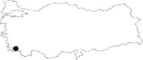
Region:
|
Aegean | |||||
|
Province:
|
Mugla | |||||
|
District:
|
Milas | |||||
|
Village:
|
Kazikli | |||||
|
|
||||||
|
|
||||||
|
|
||||||
|
TAYEx:
|
- | |||||
|
|
||||||
|
Registration State:
|
For detailed registration information please refer to Turkish pages. | |||||
 |
||||||
| Location: It lies to the south of the Kazikli Village; west of Selimiye of the Milas District of the Mugla Province [Rocca 1992a:61-62]. |
| Geography and Environment: It is located on a fertile plain surrounded by the Kazikli Mountain to the northeast and the Salta Mountain to the west. It has a sheltered port; thus it has been suggested that it was probably a significant town during the Roman and Byzantine Periods [Rocca 1992a:61-62]. |
| Destruction Details: |