| ©The Archaeological Settlements of Turkey - TAY Project | ||||||
|
|
||||||
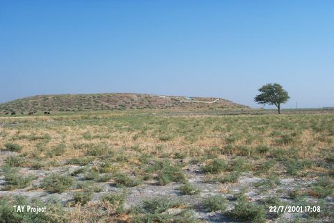
Karatepe 1 |
||||||
|
|
||||||
| Ages | Maps | Photos | ||||
| EBA |
 |
 |
||||
|
|
||||||
|
Type:
|
Mound | |||||
|
Altitude:
|
170 m | |||||
|
Diameter:
|
m- Direction: | |||||
|
|
||||||
|
Region:
|
Mediterranean | |||||
|
Province:
|
Hatay | |||||
|
District:
|
Kumlu | |||||
|
Village:
|
Karatepe | |||||
|
|
||||||
|
Destruction :
|
Contemporary Settlements - Attention | |||||
|
|
||||||
|
TAYEx:
|
Visited - 22/7/2001 | |||||
|
|
||||||
|
Registration State:
|
For detailed registration information please refer to Turkish pages. | |||||
 |
||||||
| Location: |
| Geography and Environment: |
| Destruction Details: The mound has been damaged due to contemporary settlement. There are houses on its southeastern skirt and soil removed from western skirt and the northern part has been leveled. The village road cuts its western skirt [TAYEx 22.7.2001]. |