| ©The Archaeological Settlements of Turkey - TAY Project | ||||||
|
|
||||||
Karatas Kaya Siginagi |
||||||
|
|
||||||
| Ages | Maps | Photos | ||||
| Palaeolithic/Epipalaeolithic EBA |
 |
 |
||||
|
|
||||||
|
Type:
|
Rock Shelter | |||||
|
Altitude:
|
1000 m | |||||
|
Diameter:
|
m- Direction: | |||||
|
|
||||||
|
Region:
|
Eastern Anatolia | |||||
|
Province:
|
Elazig | |||||
|
District:
|
Merkez | |||||
|
Village:
|
Meseliköy | |||||
|
|
||||||
|
Destruction :
|
Dams | |||||
|
|
||||||
|
TAYEx:
|
Not visited - 15/7/2003 | |||||
|
|
||||||
|
Registration State:
|
For detailed registration information please refer to Turkish pages. | |||||
 |
||||||
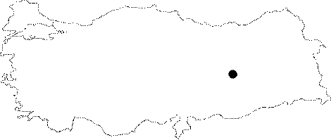
| Location: It is located next to the Elazig-Pertek motorway; some 15 km north-northeast of the Elazig Province. This rock shelter was lying on the side of a rocky block which stands like an island in the midst of the Keban Dam at present [Kökten 1974:pl.7/1-2]. |
| Geography and Environment: K. Kökten reports the presence of a small cave and a long and narrow rock shelter underlying this cave. The cave and shelter are open towards the south [Kökten 1971:15;pic.14/1]. No information was provided about the dimensions of the shelter. |
| Destruction Details: |