| ©The Archaeological Settlements of Turkey - TAY Project | ||||||
|
|
||||||
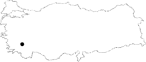
Karahisar Höyügü / Tavas |
||||||
|
|
||||||
| Ages | Maps | Photos | ||||
| EBA |
 |
 |
||||
|
|
||||||
|
Type:
|
Mound | |||||
|
Altitude:
|
870 m | |||||
|
Diameter:
|
m- Direction: | |||||
|
|
||||||
|
Region:
|
Aegean | |||||
|
Province:
|
Denizli | |||||
|
District:
|
Tavas | |||||
|
Village:
|
Karahisar | |||||
|
|
||||||
|
Destruction :
|
Agriculture | |||||
|
|
||||||
|
TAYEx:
|
Visited - 28/9/2000 | |||||
|
|
||||||
|
Registration State:
|
For detailed registration information please refer to Turkish pages. | |||||
 |
||||||
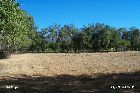
| Location: It lies south of the Karahisar Town; 10 km northwest of the Tavas District; south of the Denizli Province. |
| Geography and Environment: It is a small mound where the residents of Karahisar reported it to be flattened 20-30 years ago. It was severely destroyed due to both flattening and heavy cultivation for long years. |
| Destruction Details: The mound has been completely leveled. Currently it is covered with apple trees [TAYEx 28.9.2000]. |