| ©The Archaeological Settlements of Turkey - TAY Project | ||||||
|
|
||||||
Knidos / Deveboynu |
||||||
|
|
||||||
| Ages | Maps | Photos | ||||
| EBA Greek-Roman |
 |
 |
||||
|
|
||||||
|
Type:
|
Cemetery | |||||
|
Altitude:
|
m | |||||
|
Diameter:
|
m- Direction: | |||||
|
|
||||||
|
Region:
|
Aegean | |||||
|
Province:
|
Mugla | |||||
|
District:
|
Datça | |||||
|
Village:
|
Yazi Mahallesi | |||||
|
|
||||||
|
|
||||||
|
|
||||||
|
TAYEx:
|
Not visited - 25/9/2000 | |||||
|
|
||||||
|
Registration State:
|
Registered For detailed registration information please refer to Turkish pages. | |||||
 |
||||||
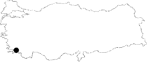
| Location: It is situated on the Tekir Promontory on the west end of the peninsula to the west of Datça District in Mugla Province. |
| Geography and Environment: The location of New Cnidus (Tekir) is a rocky land. The land is not arable. Ancient period cisterns are numerous but Bean mentioned only one fountain in his researches in 1950 [Bean-Cook 1952:184]. Due to the summer breeze from northwest Knidos is a harbor where ships frequently moor since ancient period. Therefore it is an important maritime location [Bean 2000:137]. Tekir is the only spot where fresh water is provided and it is transported via aqueducts. This is hard for the inhabitants but the city dominates the maritime lines due to its location. Two harbors were connected via a canal and protected against the tides by jetties [Bean-Cook 1952:184]. |
| Destruction Details: |