| ©The Archaeological Settlements of Turkey - TAY Project | ||||||
|
|
||||||
Kaman Kalehöyük |
||||||
|
|
||||||
| Ages | Maps | Photos | ||||
| EBA IA |
 |
 |
||||
|
|
||||||
|
Type:
|
Mound | |||||
|
Altitude:
|
1060 m | |||||
|
Diameter:
|
m- Direction: | |||||
|
|
||||||
|
Region:
|
Central Anatolia | |||||
|
Province:
|
Kirsehir | |||||
|
District:
|
Kaman | |||||
|
Village:
|
Çagirkan | |||||
|
|
||||||
|
|
||||||
|
|
||||||
|
TAYEx:
|
Visited - 30/7/2002 | |||||
|
|
||||||
|
Registration State:
|
For detailed registration information please refer to Turkish pages. | |||||
 |
||||||
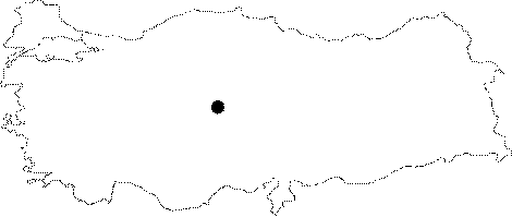
| Location: It lies next to the former Ankara-Kayseri motorway; 3 km east-northeast of the Kaman District; northwest of the Kirsehir Province. |
| Geography and Environment: To the eastern and western feet flow small streams running to the north. It is located in a fertile land. Being one of the biggest mounds in the region; it measures 16 m in height and 280 m in diameter. |
| Destruction Details: |