| ©The Archaeological Settlements of Turkey - TAY Project | ||||||
|
|
||||||
Kalinkaya |
||||||
|
|
||||||
| Ages | Maps | Photos | ||||
| EBA |
 |
 |
||||
|
|
||||||
|
Type:
|
Mound and Cemetery | |||||
|
Altitude:
|
1150 m | |||||
|
Diameter:
|
m- Direction: | |||||
|
|
||||||
|
Region:
|
Black Sea | |||||
|
Province:
|
Çorum | |||||
|
District:
|
Alaca | |||||
|
Village:
|
Merkez | |||||
|
|
||||||
|
|
||||||
|
|
||||||
|
TAYEx:
|
Visited - 15/8/2003 | |||||
|
|
||||||
|
Registration State:
|
Registered For detailed registration information please refer to Turkish pages. | |||||
 |
||||||
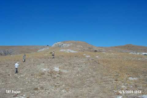
| Location: It lies 3 km northeast of Alacahöyük; northwest of the Alaca District; southeast of Kalinkaya quarter; southwest of the Çorum Province. |
| Geography and Environment: Kalinkaya is located in a region comprising high hills; narrow valleys and rocky terraces on the northern border of the Central Anatolia plateau. |
| Destruction Details: |