| ©The Archaeological Settlements of Turkey - TAY Project | ||||||
|
|
||||||
Igdeli Çesme |
||||||
|
|
||||||
| Ages | Maps | Photos | ||||
| Neolithic |
 |
 |
||||
|
|
||||||
|
Type:
|
Mound | |||||
|
Altitude:
|
1300 m | |||||
|
Diameter:
|
m- Direction: | |||||
|
|
||||||
|
Region:
|
Central Anatolia | |||||
|
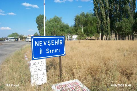
Province:
|
Nevsehir | |||||
|
District:
|
Acigöl | |||||
|
Village:
|
Yalman | |||||
|
|
||||||
|
Destruction :
|
Contemporary Settlements | |||||
|
|
||||||
|
TAYEx:
|
Visited - 4/8/2002 | |||||
|
|
||||||
|
Registration State:
|
For detailed registration information please refer to Turkish pages. | |||||
 |
||||||
| Location: This site lies southwest of the site of Nevsehir; 7 km west of Acigöl; on the northern side of the Aksaray-Nevsehir highway; near the water fountain. |
| Geography and Environment: The name of the site probably comes from the water fountain. This spring must also have attracted early settlers to the site. When the site was discovered in 1964; it was under cultivation. Todd believes that the site; before it was damaged by plowing; was either a low broad mound or an open-air site. The extent of the site could not be measured. It has been determined that the obsidian finds were spread over an area larger than 200 m on the northern side of the highway. No finds were found on the southern side of the highway; although Igdeli Tepe; a hill on the southern side; yielded 30 obsidian finds. These finds may indicate a second site. |
| Destruction Details: The site is being used as garbage dump area of the gas station [TAYEx 4.8.2002]. |