| ©The Archaeological Settlements of Turkey - TAY Project | ||||||
|
|
||||||
Alayhan Höyük |
||||||
|
|
||||||
| Ages | Maps | Photos | ||||
| EBA IA |
 |
 |
||||
|
|
||||||
|
Type:
|
Mound | |||||
|
Altitude:
|
1205 m | |||||
|
Diameter:
|
80 m- Direction: N-S | |||||
|
|
||||||
|
Region:
|
Central Anatolia | |||||
|
Province:
|
Aksaray | |||||
|
District:
|
Merkez | |||||
|
Village:
|
Alayhani | |||||
|
|
||||||
|
Destruction :
|
Illicit Digging - Agriculture | |||||
|
|
||||||
|
TAYEx:
|
Visited - 4/8/2002 | |||||
|
|
||||||
|
Registration State:
|
For detailed registration information please refer to Turkish pages. | |||||
 |
||||||
| Location: |
| Geography and Environment: |
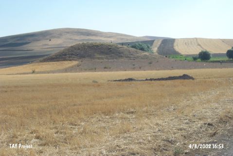
| Destruction Details: The mound is being damaged due to agricultural activities and illicit diggings. There is a pit on its southwest skirt. The skirts of the mound are leveled for making way for fields [TAYEx 4.8.2002]. |