| ©The Archaeological Settlements of Turkey - TAY Project | ||||||
|
|
||||||
Hiznik - Fal Arasi |
||||||
|
|
||||||
| Ages | Maps | Photos | ||||
| Palaeolithic/Epipalaeolithic |
 |
 |
||||
|
|
||||||
|
Type:
|
Single Findspot | |||||
|
Altitude:
|
m | |||||
|
Diameter:
|
m- Direction: | |||||
|
|
||||||
|
Region:
|
Southeastern Anatolia | |||||
|
Province:
|
Adiyaman | |||||
|
District:
|
Besni | |||||
|
Village:
|
Kutluca | |||||
|
|
||||||
|
|
||||||
|
|
||||||
|
TAYEx:
|
Not visited - 29/8/2001 | |||||
|
|
||||||
|
Registration State:
|
Registered For detailed registration information please refer to Turkish pages. | |||||
 |
||||||
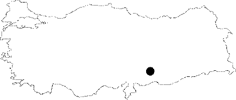
| Location: This site is southwest of the city of Adiyaman at the top of a 780 m high hill between the village of Iznik (also known as Hiznik); which is about 7 km northeast of the town of Çakirhöyük (previously called Keysun) and the village of Fal (Kutluca); 5 km to the northeast. |
| Geography and Environment: We lack further geographical and environmental descriptions of the site. Archaeological publications have also referred to the site as Keysun after the town; although this name is incorrect. |
| Destruction Details: |