| ©The Archaeological Settlements of Turkey - TAY Project | ||||||
|
|
||||||
Hisarlik / Troia |
||||||
|
|
||||||
| Ages | Maps | Photos | ||||
| EBA IA 14C |
 |
 |
||||
|
|
||||||
|
Type:
|
Mound | |||||
|
Altitude:
|
85 m | |||||
|
Diameter:
|
m- Direction: | |||||
|
|
||||||
|
Region:
|
Marmara | |||||
|
Province:
|
Çanakkale | |||||
|
District:
|
Merkez | |||||
|
Village:
|
Tevfikiye | |||||
|
|
||||||
|
|
||||||
|
|
||||||
|
TAYEx:
|
Visited - 22/6/2000 | |||||
|
|
||||||
|
Registration State:
|
For detailed registration information please refer to Turkish pages. | |||||
 |
||||||
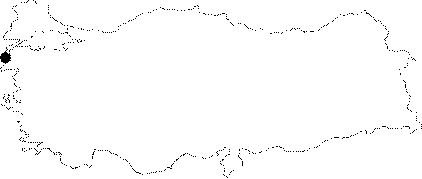
| Location: The ancient city of Troy/Troia/Troié is hypothetically located on the Hisarlik hill which is overlooking the shore plains formed by the Dumrek and Kara Menderes streams; 4.5 km away from the Dardanelles; 6 km from the Aegean Sea; about 30 km south of Çanakkale Province. The name which reads Troia in Hellenistic language is known as Truva in Turkey with its pronunciation in French. |
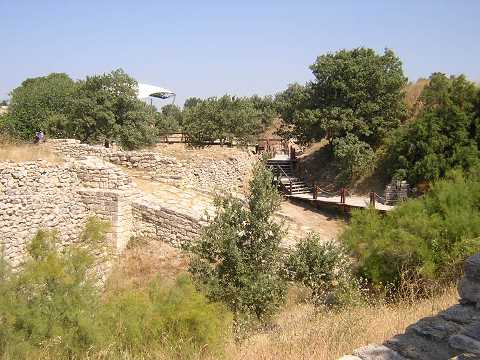
| Geography and Environment: The Hisarlik Tepesi measures 31.2 m in height above the plain level and ca. 200x150 m in dimensions. The ancient cities located on an outcrop on the foothill of a calcareous platform were not only built on the uphill; but also on the slopes (lower city). It houses a cultural deposit of 16 m thick. The geomorphological studies suggested that the Troy of EBA was located on the shore of a small bay where the Kara Menderes and the Dümrek streams spill to. The site is very suitable for occupation. |
| Destruction Details: |