| ©The Archaeological Settlements of Turkey - TAY Project | ||||||
|
|
||||||
Hasiye |
||||||
|
|
||||||
| Ages | Maps | Photos | ||||
| EBA |
 |
 |
||||
|
|
||||||
|
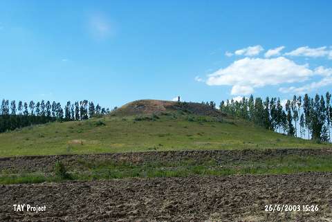
Type:
|
Mound | |||||
|
Altitude:
|
1870 m | |||||
|
Diameter:
|
31 m- Direction: E-W | |||||
|
|
||||||
|
Region:
|
Black Sea | |||||
|
Province:
|
Bayburt | |||||
|
District:
|
Demirözü | |||||
|
Village:
|
Aksaçli | |||||
|
|
||||||
|
Destruction :
|
Illicit Digging - Attention | |||||
|
|
||||||
|
TAYEx:
|
Visited - 26/6/2003 | |||||
|
|
||||||
|
Registration State:
|
For detailed registration information please refer to Turkish pages. | |||||
 |
||||||
| Location: |
| Geography and Environment: |
| Destruction Details: The northeastern and southeastern slopes of the mound have been cut. Two illicit digging pits were observed on the top section [TAYEx 26.6.2003]. |