| ©The Archaeological Settlements of Turkey - TAY Project | ||||||
|
|
||||||
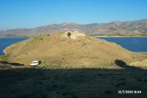
Haraba Tepe / Elmapinar |
||||||
|
|
||||||
| Ages | Maps | Photos | ||||
| Chalcolithic |
 |
 |
||||
|
|
||||||
|
Type:
|
Mound | |||||
|
Altitude:
|
890 m | |||||
|
Diameter:
|
250 m- Direction: E-W | |||||
|
|
||||||
|
Region:
|
Eastern Anatolia | |||||
|
Province:
|
Elazig | |||||
|
District:
|
Palu | |||||
|
Village:
|
Örencik | |||||
|
|
||||||
|
Destruction :
|
Illicit Digging | |||||
|
|
||||||
|
TAYEx:
|
Visited - 12/7/2003 | |||||
|
|
||||||
|
Registration State:
|
For detailed registration information please refer to Turkish pages. | |||||
 |
||||||
| Location: |
| Geography and Environment: |
| Destruction Details: The site has been damaged by agricultural activities and illicit diggings. Soil taken from west slope and north-northwest section is being planted. Wall remains of the castle on the mound can be seen on east and west slopes. There is a narrow cleft on top hill and lots of pits on all over the mound. [TAYEx 12.7.2003]. |