|
©The Archaeological Settlements of Turkey - TAY Project
|
|
|
|
|
|
Degirmentepe |
|
|
For site maps and drawings please click on the picture... 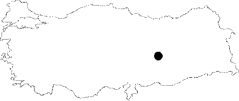 |
For photographs please click on the photo...  |
|
Type:
|
Mound |
|
Altitude:
|
650 m |
|
Region:
|
Eastern Anatolia |
|
Province:
|
Malatya |
|
District:
|
Battalgazi |
|
Village:
|
Imamli |
|
Investigation Method:
|
Excavation |
|
Period:
|
|
|
|
|
 |
|
| Location: The site lies approximately 24 km northeast of Malatya; northeast of Battalgazi (Old Malatya) District; north side of the gravel road between Imamli Village and Adagoren Village. It has been inundated by the Karakaya Dam on Euphrates. The location code of the site is P 50 / 7. |
| Geography and Environment: The first settlement of the mound; located on the bank of Euphrates (40 m from the river in the present time); was founded on a natural conglomeratic elevation near the river. It is interpreted that the elevation was near the river during the first inhabitation; and the inhabitants used the Euphrates as a water source. Before the inundation; the mound was 12 m high above the level of the river bank; and 4.5 m high above the level of the southern road. It was 125 m wide in the north-south direction; 200 m long in the east-west direction; and looked like a "8" shaped; medium mound. The northern section ends with a steep slope at the fields near Euphrates; while the southern section is slightly sloped towards the road. Before the excavation; no damage was observed besides ploughing; and the overflowing of Euphrates. The mound used to be located on a narrow plain surrounded by fertile fields near Euphrates [Esin 1994:85-86]. |
| History: |
| Research and Excavation: Degirmentepe Mound was first identified by Ü. Serdaroglu et al. during the Surveys in the Lower Euphrates Basin in 1975 as Adagören (Kilisik) mound. The salvage excavations, which were initiated under the direction of U. Esin in 1978, lasted until 1986 on behalf of the Department of Prehistory, University of Istanbul Üniversitesi. |
| Stratigraphy: The excavations yielded 11 levels, which included finds from the Middle Age (Byzantine, Late Roma Periods), Iron Age, First Bronze Age (Karaz), and Chalcolithic Age. |
| Small Finds: Architectural Remains: To the southwest and south stand the domestic buildings, and to the northeast rises a small fortress in circular plan, and to the southeast of the fortress lies a necropolis consisting of pithos burials. There is an Iron Age cemetery in an area furnished with mudbricks to the south of the fortress. Small pits were opened into the mudbrick pavement, placing the pithos graves into them. The domestic buuildings have stone foundations, mudbrick walls in a rectangular plan, adjacent to each other. Some include interior mudbrick walls, benches, tandoors and circular fire places. The fortress has quadrilateral bastions. The main character of the Late Iron Age architecture, which covers almost all over the mound, is represented by domestic structures in square and rectangular plans built with stones. Pottery: It exhibits a mixed combination of the Late Hittite, Urartu and Late Assyrian Period sherds. Many sherds representing the Karaz culture were found on the southwestern section of the mound. Degirmentepe is, so far, the best representative of the Ubaid culture to the north of the Taurus range of mountains. Pottery of Ubaid culture usually consists of greenish, buff, pinky and light colored clay. A small group of ceramics is red-slipped and burnished. Very restricted number of sherds dating to the Iron Age were uncovered. Rubbing Stone: Several tools and instruments made of terracotta, ground stone, polished stone and flintstone for daily use were found in the central courtyards of large building units, particularly in some storerooms. Metal: Copper slags were found inside and near some of the big kilns at Degirmentepe. Analysis showed that copper was smelted at 1200 degrees. Seal/Seal Impression: Plenty of stamp seals in steatite and stamped seal impressions on clay were recovered. The seals are depicted with geometric, shematic, vegetational and animal patterns as well as human figures. The depictions on seals were scraped by small flintstone piercing tools and chisels. Recovery of both stamp seals and stamp impressions on clay mainly in the southwestern building among the buildings with three divisions gives the impression that this place belonged to the privileged people of the society. Abundancy of seals at Degirmentepe indicate that inhabitants of this period were intensively involved in trading activities. Human Remains: Children were usually buried into pits opened into the virgin soil in "hocker" position in the central courtyard. Infants were left into the pits dug under the floors of some rooms on the wings, and into niches on the walls in vessels. |
| Remains: |
| Interpretation and Dating: The excavations yielded 11 building levels from the Middle Age dating back to the Chalcolithic Age. Continous occupation indicates significance of the mound. It bears the characteristics of a commercial center. |