|
©The Archaeological Settlements of Turkey - TAY Project
|
|
|
|
|
|
Kyzikos |
|
|
For site maps and drawings please click on the picture... 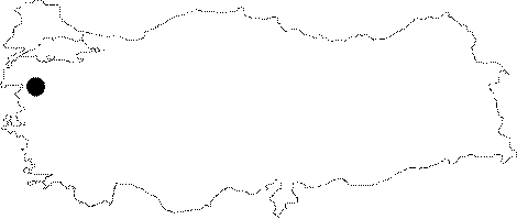 |
For photographs please click on the photo...  |
|
Type:
|
City |
|
Altitude:
|
m |
|
Region:
|
Marmara |
|
Province:
|
Balikesir |
|
District:
|
Erdek |
|
Village:
|
Merkez |
|
Investigation Method:
|
Excavation |
|
Period:
|
Classical Archaic |
|
|
|
 |
|
| Location: It lies to the north of a swampland between the Erdek and Bandirma Bays on the peninsula of ancient Arctonnessos (present Kapidag) within the borders of the Erdek District in Balikesir [Yaylali 1991:171]. |
| Geography and Environment: Having a strategic position in Propontis, Kyzkios (Cyzicus) lies to the north of the isthmus linked by Arctonnesus to the mainland. It is also called "Belkis" or "Balkız" at present. The settlement is delimited by the Mount Dindymos (Ayi Dagı), and the villages of Hamamli and Belkis (Yeniköy) to the north; the Erdek Körfezi and the village of Düzler to the west; the Erdek-Edincik-Bandirma motorway to the south; and the village of Asagiyapici and the Bandirma Bay to the east [Yaylali 1991:178]. |
| History: |
| Research and Excavation: The site was first inspected by Cyriacus of Ancona between 1431 and 1444. Later in the 19th century Marquardt Grigoria and in the 20th century R. de Rustafjell, F.W. Hasluck and A.E. Handerson also inspected the site to identify it [http://www.kyzikos.net/kazi-baskani.html, 11.02.2019; 16:48]. The excavations which were initiated by Ekrem Akurgal started as soundings in 1950s. Reşit Mazhar Ertüzün included history of Kyzikos and its finds in his book "Kapidagi Yarimadasi ve Çevresindeki Adalar" published in 1964. However, the finds related with the Iron Age were not detailed in the book. The excavations conducted under the direction of Abdullah Yaylali between 1989 and 1996 focused only on the Temple of Hadrian and its vicinity. Since 2006, it has been excavated by Nurettin Koçan. |
| Stratigraphy: |
| Small Finds: Architecture: The principal remains, although partly traceable, are the fortification walls enclosing Kyzikos on four sides. With some sections dating back to the 4th century BC, the majority of the extant walls belong to the Roman and Byzantine Periods [Yaylali 1991:179]. Pottery: The soundings conducted in 1957 by E. Akurgal yielded a mixture of the Archaic Period ceramics and the late period ceramics. Unfortunately, further investigation is impossible as the Archaic city of Kyzikos has currently remained below the sea level [Akurgal 1958:633]. Statue/Relief: A statue made of white marble stands on an oval pedestal, measuring 6 cm in height, ca. 35 cm in lenght, and 23 cm in width. The 80 cm high statue should have belonged to the second quarter of the 6th century BC [Koçhan 2002:376-378]. The excavations conducted in 1957 by E. Akurgal yielded a marble columna caelata with a relief of youthful dancers from the Archaic Period [Mellink 1959:85]. |
| Remains: |
| Interpretation and Dating: The city was initially called Dolionis because of the Doliones who settled down here [Yaylali 1991:178]. Following its foundation by Miletus in 756 BC, it was attacked and destroyed by Kimmerians, and re-founded in 679 BC by Megarians [Graham 1982:119; Aktüre 2003:212]. She declared her independence during the 4th century BC [Yaylali 1991:178]. It has been reported that besides her political power, the city had also greatly evolved in art. In addition to the architectural remains, the finds indicate that magnificent works of art were produced in sculpture during the 6th century BC [Koçhan 2002:376]. All monumental structures built in the city were decorated with local marbles in various colors. Strabon mentiones presence of three architectural workshops at Kyzikos, which were compatible with other cities in Anatolia [Basaran 1997:3]. |