|
©The Archaeological Settlements of Turkey - TAY Project
|
|
|
|
|
|
Fethiye / Hasan Badrak |
|
|
For site maps and drawings please click on the picture...  |
For photographs please click on the photo... 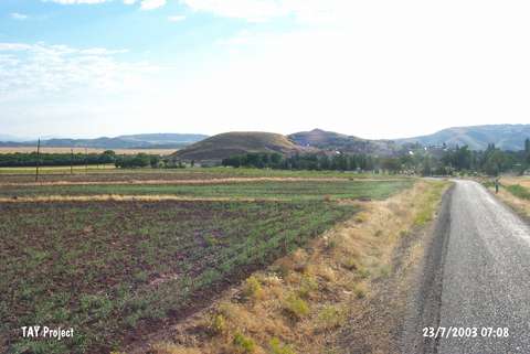 |
|
Type:
|
Mound |
|
Altitude:
|
900 m |
|
Region:
|
Eastern Anatolia |
|
Province:
|
Malatya |
|
District:
|
Yazihan |
|
Village:
|
Fethiye |
|
Investigation Method:
|
Survey |
|
Period:
|
Middle |
|
|
|
 |
|
| The round mound; measuring 15 m in height and 100 m in diameter; lies north-northwest of the city of Malatya and of Yenihan Distirct; southwest of Fethiye Village. The site was not effected by Karakaya Dam. It was discovered by H.H. von der Osten in 1928 and visited by researches such as K. Kökten; C.A. Burney and P. Meriggi. According to the observation of Russell during the surface collection of Burney; sherds in chaff-faced ware made on the tournette; belong to the Middle Chalcolithic Age [Russell 1980:44]. It takes place in the registered archaeological sites list prepared by Ministry of Culture and Tourism. |
| Location: |
| Geography and Environment: |
| History: |
| Research and Excavation: |
| Stratigraphy: |
| Small Finds: |
| Remains: |
| Interpretation and Dating: |