|
©The Archaeological Settlements of Turkey - TAY Project
|
|
|
|
|
|
Kertenkele Kalesi |
|
|
For site maps and drawings please click on the picture... 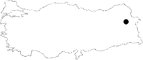 |
For photographs please click on the photo...  |
|
Type:
|
Fortress |
|
Altitude:
|
m |
|
Region:
|
Eastern Anatolia |
|
Province:
|
Agri |
|
District:
|
Dogubayazit |
|
Village:
|
Gökçekaynak |
|
Investigation Method:
|
Survey |
|
Period:
|
Early Iron Age |
|
|
|
 |
|
| It is situated on a steep rock known as Kertenkele, north of the Gökçekaynak Village, 9 km southwest of the Dogubeyazit District in Agri. The necropolis area of the fortress expands onto the eastern skirts of the rock and onto a low and small size hill to the east. Grinding stones were exposed during the excavations conducted by C. Bozkurtlar, director of the Van Museum between 1974 and 1975. The walls of the grave chambers were built using the corbelling technique. Pottery of Kertenkele bear characteristics of the Early Iron Age. The vessels are well-burnished in light grey with a bright appearance, and crested with a smoothly rising rim, and fluted in parallel to the rim with pierced lugs and single vertical handle. Some are red slipped. The decorations on the vessels and the spouted jugs are important. Identicals of the two- and three-spouted jugs often seen in the Early Iron Age necropolises of Elazig-Malatya in the Northeast Anatolia are found here. |
| Location: |
| Geography and Environment: |
| History: |
| Research and Excavation: |
| Stratigraphy: |
| Small Finds: |
| Remains: |
| Interpretation and Dating: |