|
©The Archaeological Settlements of Turkey - TAY Project
|
|
|
|
|
|
Kerkenes Dag |
|
|
For site maps and drawings please click on the picture... 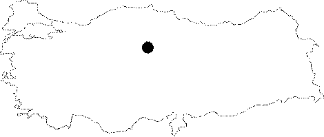 |
For photographs please click on the photo...  |
|
Type:
|
Mound |
|
Altitude:
|
m |
|
Region:
|
Central Anatolia |
|
Province:
|
Yozgat |
|
District:
|
Sorgun |
|
Village:
|
Sahmuratli |
|
Investigation Method:
|
Excavation |
|
Period:
|
Middle Phrygian Late Phrygian |
|
|
|
 |
|
| Location: It lies 5 km west of the Sahmuratli Village, southeast of Yozgat. |
| Geography and Environment: It is a city built at a very high altitude (1500 m) on a granitic mountaintop on the northern end of the Cappadocia Plain, with skillfully erected fortifications on the sloping ridges. |
| History: The Iron Age capital among the many large and impressive settlements of Anatolian Plateau, which is also most probably Pteria mentioned by Herodotus, was founded here around 600 BC. The city was looted and burnt around the middle of 6th century BC, its 7 km long walls containing 7 gates were destroyed and the settlement was entirely abandoned [Summers 2008:477]. |
| Research and Excavation: The site was first documented during the late 19th century by J.G. Anderson, and in 1927 H.H. von der Osten and H.F. Blackburn produced an accurate map of the city and the defenses, which was followed by E. Schmidt, who revealed by 14 soundings that it was an Iron Age settlement. G. Summers and his team started the excavations by surveying the site with remote sensing and resistivity techniques in 1993. Until 2011 the team used resistivity surveys to create a complete urban plan of the site. Directorate of Yozgat Museum was in charge of the excavations at Kerkenenes between 2012 and 2014. Since 2015 S.A. Branting has conducted the excavations. |
| Stratigraphy: It is a single stratum site. It was probably founded in the very late 7th century BC, and the buildings were set on fire, and the fortifications were demolished before it was completely abandoned in the mid-6th century BC. |
| Small Finds: Architecture: The city was enclosed by a fortification wall of 7 km long, covering an area of 2.5 square kilometers. Only one of the seven gates piercing the city walls has been partially excavated. This gate called the "Cappadocia Gate" was built of stones, and has been preserved up to 5 m high at some points. It seems that following a catastrophic fire, the superstructure of the defense walls was deliberately shattered and thrown away to prevent any future use. A stepped monument on which an idol stood was found within the Cappadocia Gate. On the southern section of the city rises a large palatial complex with a strategic location overlooking the environment. A columned hall and two towers exist in the paved area at the entrance to the palace. The lower sections of the towers were erected with dressed granite blocks while the upper sections with a course of yellowish sandstone followed by a course of soft white limestone. Between the courses were large timber beams. When the city was set on fire, the timber beams incited the fire, resulting in vitrified blocks of granite and melting of sandstone. Among the burnt debris are many fragments of relief sculptures, a large portion of a human statue, and inscriptions in Phrygian. In front of the palatial building, there is an artificial pond (Sülüklü Göl/Leech Pond). The surveys conducted in the lower part, center and northern section of the city yielded streets, open areas, and a complicated water management system. A large portion of the lower city was divided into quarters, and each unit was bounded by stone terrace walls on three or four sides. The geophysical survey yielded two megaron-like structures at the city center. In 2003 a square hall and a central hearth with an open colonnaded area (portico) in front were exposed in one of these structures. This complex may represent a public building. Geophysical survey demonstrated no architectural remains in the wide terrain to the southeast of the Big Pond, the largest artificial reservoir of the city. An interesting find of this survey was a large structure (27x15 m) with two rooms fronted directly onto the street, which is believed to have been a temple. A geomagnetic survey previously revealed that this structure was exposed to the fire unlike the smaller structures surrounding it. S. Branting worked on applying geographical information systems (GIS) for a simulation of the ancient pedestrian traffic within the city, and he made a test in 2004 by excavating three trenches. Micromorphological analyses on surface samples from the layers believed to have belonged to the streets showed that there were unpaved streets, and some of them had deposits of wastes from the neighboring residential blocks. Geophysical survey performed with ground resistance meter in 2007 revealed that the large Structure A that composes the east end of Palace Buildings Group and the inclined stone covered surface (glacis) that supports it belong to an earlier phase, and most probably to the initial foundation period of the city. A 140 m long trapezoid formed structure island which is the largest that was identified in the city is located in the west of the city. Among the most remarkable structures located on this island of buildings is the one located south of the center containing a rectangular planned hall, and rectangular planned front room. Again among the crowded buildings of the same island a series of cells possibly built for storage become prominent. Besides those a third two-room-building with a hearth in the center of its hall on the other side of the stone paved patio east of the Cut Stone Structure was identified. A Monumental Entrance was added during a phase around the destruction and desertion of the city. Smaller islands of structures divided through a grit-formed street system was observed that suggests the presence of a central planning authority. It is assumed that these structure islands are tiny applications imitating the original island that contains the Palace Structures Group [Summers 2010:38-39]. The results obtained from the area neighboring the Palace Complex during 2008 excavations revealed a few urban building blocks on both sides of the main streets and the structures that formed those blocks in detail. That street extends between the Palacial Complex and Göz Baba Gate [Summers et al. 2010:52]. During 2009 the surveys are concentrated in Cappadocia Gate which is on the other side of the main road which starts from East Gate, passes through Palace Building Group and reaches to Gözbaba Gate, i.e. on the other side of the group of buildings which are defined as Kingdom's Stables are located in the Southwest of the antique acropolis. A stone paved road and its attachment structures, a water channel crossing the attachment structures, an aniconic granite stele on the corner of the center tower, and a partially burned human skeleton is unearthed during these studies. During the excavations carried out where the Northeastern corner and city wall is combined, it is observed that the slopped stone surface is totally destructed [Summers-Summers 2011:383-384]. The width of two stable buildings which are defined as Kingdom's Stables are almost 20 m. Other large buildings also exist in Kerkenes having similar roof sizes [Summers-Summers 2011:383]. The 2010 excavation campaign was carried out in the temple and the Cappadocia Gate. During the temple excavations, a large structure with two rooms (Structure A) and a vast majority of a small structure in square plan just behind it were exposed in the trenches of TR27 and TR28. Large amount of objects were found on the stone covered floor of the northern room of Structure B. The finds consist of fragments of burnt tree remains belonging to the wooden door located between two rooms and fragments of perforated iron bands which were used for holding together the door. There are also one arrowhead made of copper composite, a stone bowl with three feet, a small bead made of tin-antimony composite, two star shaped silver objects, lots of medium sized potsherds among the finds [Summers et al. 2012:536-537]. The 2012 excavations concentrated in the Urban Block 8 and the city wall and its vicinity near the East Gate. Two trenches were opened in the Urban Block 8. A new trench labeled as TR31 was opened in the southeast corner, in front of three juxtaposed rooms that were unearthed in TR29 in 2011. In the north of the trench, a staircase providing access to the Third Room, which was discovered in TR29 in previous years, was found. The staircase consists of 6 large stone stairs. The staircase reaches to the stone paved area in the center of the trench. The postholes on the stone pavement indicate the existence of a wooden roof. The stone pavement is surrounded by walls with stone foundation in the south and east. There is a small room in the east of the trench. To the south, sections belonging to another room were unearthed. A channel system, which drains water flowing from the front wall of the structure in TR29, was discovered in the west of the pavement. The following excavations took place in the area, which was determined during the sounding conducted in previous years, in the south. Some parts of the stone pavement in front of the large room that is located in the same area with TR33 were unearthed. 6 postholes were found in the south of the stone pavement that covers the entire trench. TR31 yielded some potsherds and bones. An iron pin was found in the east room. A broken fibula fragment was recovered from the stone pavement, near the threshold of the room in the south and worked ivory fragments were found in the southern edge of the south room. TR33, on the other hand, yielded a few potsherds and bones, a broken iron nail and fragments of bronze plaques [Baran 2014:77]. The excavations were carried out in the east section of the city wall near the East Gate as well. This area is located on the slope of the acropolis hill. The studies were conducted in five trenches (namely TR32, TR34, TR35, TR36 and TR37). In TR32, the inner filling stones of the city wall were exposed immediately below the surface. The city wall unearthed in TR34 was built with large stones and the spaces among these stones were filled with relatively smaller stones without mortar. The inclined revetment walls bearing characteristics of the Archaic Period were built in front of the city wall. These walls supported the thick city walls and probably built for preventing the enemies to hide at the bottom of the walls in case of a probable attack. It was observed that the city wall formed a corner by turning to the southeast in TR36. A staircase was found in the south of the corner. The staircase, five stairs of which were exposed so far, reaches to the upper section of the city wall. The stairs measures about 80 cm in length, 40 cm in width and 30 cm in height. These stairs belong to the original construction phase of the city wall. The inner section of the east city wall yielded glass beads, glass bracelet fragments, bronze and iron fibula pieces, bronze arrow heads, bronze bands, iron nails, which vary from the Archaic to Byzantine periods, and a great number of painted and plain potsherds belonging to the Phrygian Period. In the East Urban Block, the studies were carried out in TR38 that was opened near the East Gate. A large number of wall remains were seen on the surface of this area. These wall remains belong to the large building complex located at the side of the main street originating from the East Gate. The excavations conducted at the southeast corner of the area show that the area has been heavily damaged due to the slope. Therefore, only one or two rows of the walls could be preserved up to date [Baran 2014:78-81]. In 2013 studies carried out in TR 37-D, it was observed that a section of the sloping city wall has been entirely damaged. Wall remnant was exposed in the south of the large blocks belonging to the city wall. This wall is partially connected to the outer city wall. It is found out that the wall belongs to the north wall of the defense tower. The architectural differences seen on the joint section of two walls make one thinks that this section of the outer city wall underwent repair. The inner walls of Tower I, which extend in the east-west direction, are surrounded by sloping city wall. However, it doesn't turn and join the city wall in the north-south direction as Tower II. It lies in a straight line and joins the outer city wall. In TR 39-B, only 4.80 m of the east support wall of Tower I could be followed. The city wall was built with small stones placed on large stones. Tower II is located 10 m south of Tower I. It is well preserved and it measures 11.50 m in height. The south wing of Tower I has been damaged. Tower I is preserved up to 9.50 m in height. Tower I and II was built to defend the city against the attacks coming from the valley. Tower III, on the other hand, was designed to avoid the attacks coming from the door. In TR38, 13 trenches in total were excavated and architectural remains were exposed. Sherds belonging to common wares and a nail were found in TR38 [Baran et al. 2015]. During the 2014 season, the excavations were carried out in two trenches (TR33 and TR40). These trenches are located within Urban Block 8 in the northwestern part of the city. These excavations were carried out in order to reveal what an urban block looked like and to understand how the different buildings and areas were used by its inhabitants in their daily lives. 366 square meters in total were excavated. A total area of 600m2 of the urban block that has been exposed. The excavations begun in 2012 in TR33. During this excavation season, a stone paving in front of a large columned structure was exposed. During the 2014 season, a covered stone drain that extends under the pavement was discovered. The drain is about 30 cm wide and extends in the north-south and continues towards the east of the large columned structure. There are also some gaps in the pavement indicating the existence of posts or other temporary installations. TR40 is located to the north of TR33. It covers an area of 216 square meters. A large building measuring 26x18 m was discovered in this trench. The long eastern wall and interior cross wall have some traces of plaster. The plastering on the exterior wall indicates the presence of an additional room located to the east of this building [Branting et al. 2016:3]. Pottery: In TR33, scattered pottery sherds were found upon the paving in 2014. TR40 also yielded scattered potsherds. Among these sherds, the round jar stopper and a sherds with incised markings are noteworthy [Branting et al. 2016:3-4]. Clay: TR33 yielded a small plain clay bead in 2014 [Branting et al. 2016:3]. Chipped Stone: An obsidian flake was found on the paving in TR33 in 2014 [Branting et al. 2016:3]. Bone/Antler: In 2014, over 500 pieces of worked bone and ivory inlay were found in the northeastern corner of the antechamber and along its eastern wall in TR40. These woeked bones include numerous examples bearing simple geometric designs, possible human figures in framed relief and a carved palmette. These finds are probably part of a production process rather than a cluster [Branting et al. 2016:5]. Metal: In 2014, several iron nails (possibly coming from the façade of the large columned structure), pieces of bronze sheet with a nail, a copper alloy pin, a copper alloy spiral, and an iron arrowhead were found in TR33. Iron nails, pieces of metal sheet and a piece of iron band, which were likely part of the superstructure of the building, were found in TR40 in 2014. Several metal tools and objects were also found. An iron axe head was exposed within the debris of the eastern wall. A piece of iron awl and iron pin was discovered in the southern part of the interior hall. An iron hand-scythe with a serrated edge was also found in the northeastern corner of the antechamber [Branting et al. 2016:3-5]. Statue/Relief: The area around the gate had been severely disturbed by treasure hunters during the Byzantine Period, and by burials of the same period. Fragments of a sandstone statue of a human figure, slightly higher than 1 m were found in a pit from the Byzantine Period. The figure has shoulder-lenght hair, holding a rod in the right hand, and wearing a pleated skirt, a belt and a plain top. Some dowel holes were cut in the base and side of the skirt. Identification of the figure is unclear. The fragment of the upper part of stele that belongs to stepped monument in the internal patio was found next to Cappadoce Gate in 2006. That fragment suggests that the empty face of half-iconic Phrygian idol was round shaped and the symbolic curled hairs on its shoulders had spiral pillow formed objects in the ends. The statue certainly was influenced by Phrygian style most probably depicts a male administrative officer [Summers 2008:482]. |
| Remains: |
| Interpretation and Dating: During 2009, the architecture of Kingdom's Stables was the focus of studies. Slopped mat roofs which were supported with 2 columns of wide wooden poles sitting on the stone bases were used to cover the tops of the similar buildings in Kerkenes. Similar roofs are encountered in the buildings of Gordion during 9th Century BC. However the wooden poles bearing the slopped roofs of the megarons were sitting on wooden traverses instead of independent pole holes. The region was subjected to heavy snow and a tratched roof couldn't possibly be slopped less than 40 degrees. Such a roof must have an 8 m tip at the least. Therefore it is believed that these buildings must have a height of at least 12 m. On the other hand there is no positive sign for the pole holes [Summers-Summers 2011.383]. |